A new interactive report, 'Meeting Net Zero with the Power of Place', has been published to explore the opportunities for location intelligence in the fight against climate change.
The report, which comprises videos and podcasts as well as written commentary, explores the vast potential of geospatial data, innovation inclusive growth, collaboration, system thinking and cultural change in dealing with global challenges, including:
Energy – Geospatial data has the potential to uncover suitable sites for greener energy generation such as solar, wind and wave power, the locations for such sites are predicated by earth observation data on geography, natural climates, and prevailing weather conditions.
Nature – Satellite cameras allow for real-time monitoring of deforestation around the world. Global Forest Watch monitors 600 million hectares of forest at any one time and has alerted authorities of illegal mining and logging in protected areas of the Amazon – this has enabled action to be taken against these activities within 24-48 hours of receiving an alert.
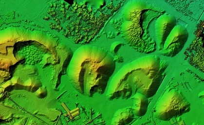
Built Environment – British geospatial companies are working with Homes England and Welsh Government to help urban planners create more resilient urban environments, that factor in sustainability and net zero. They can identify development sites using geospatial data including flood alert areas, local authority green belts, local transport hubs and drone footage.
Transport – 4G and 5G cellular data can help plan the installation of EV charge points by tracking popular routes, particularly as coverage extends into rural areas.
The fully interactive report includes an eight-part podcast series covering geospatial innovation, financing, nature, the built environment, transport and energy, with guest speakers from The Nature Conservancy, the Coalition for Forest Nation, the Geospatial Commission, the Climate Change Committee and Planet.
It comes six months after an 11-day space and geospatial online fringe event at COP26, curated by over 30 partners including former US Vice President and climate activist, Al Gore, with the aim to maintain the momentum generated by the event.
Innovate UK KTN hopes it will inspire innovators to continue engaging with the people and organisations who are looking to use location intelligence and space data to create innovative solutions here on the ground.
Luca Budello, who leads on Geospatial Data at Innovate UK KTN and co-author of the report said: “It feels great to launch this report. The Space & Geospatial Virtual Pavilion at the end of the last year was an important collaboration that we have established between national and international partners to promote the role of space data and geospatial analytics in tackling climate change and meeting Net Zero targets. Now we need to take it a step further and start taking advantage of the opportunities.
“Technology has an important role to play but to deliver solutions that work for all of society we need to think bigger. This report explores how we need to change our ways of thinking to be more collaborative, more holistic in our approach, and more inclusive if we’re going to see change happen at the pace needed to deal with these big global challenges.
“I encourage you to read the report, listen to the upcoming Geo for Earth podcast series, and get in touch if you think you can work together with us to deliver positive change.”
The full report is available at: https://rebrand.ly/ktn_nzlive


