September 2016
Life in the extremes: confessions of an astrobiologist
September 2016
Life in the extremes: confessions of an astrobiologist
... States. Antarctic Dry Valleys from low Earth orbit based on a NASA Landsat 7 photograph and using ArcGIS software. The invention of the polymerase chain reaction (PCR) using the heat-resistant enzyme Taq DNA polymerase...
 September 2016
URBOCOP: saving planet Earth
September 2016
URBOCOP: saving planet Earth
... scientist and a visionary, holding a PhD in Computer Science and Engineering. He founded Socium in 1988 - originally a small software and consulting company, now a large holding with over 8,000 employees in 30 companies worldwide - and the Aerospace...
 January 2017
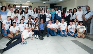
Israeli students inspired by nano-satellite projects
January 2017
Israeli students inspired by nano-satellite projects
... solution. Every student is assigned one of the main aspects in the design of a satellite subsystem - thermodynamics, communications, software, etc. The teams and their mentors cooperate - just like branches of a start-up company, except the final...
 August 2017
Space invaders and the usual suspects - disruptive trends in Earth observation
August 2017
Space invaders and the usual suspects - disruptive trends in Earth observation
... community. Orbital Insights gathers its data through contracts with EO data owners and the start-up develops software to extract insights from satellite and aerial imagery. Trends in commercial imagery - resolution versus revisit. Another example...
 September 2017
India’s dynamic ecosystem for space entrepreneurship
September 2017
India’s dynamic ecosystem for space entrepreneurship
...or integrate into industries on the ground. A step beyond The proof of availability of several reliable and scalable (hardware/software) platforms, trends towards low-cost access to space, integration into industry 4.0, and global business models are...
 October 2017
The sci-fi noir world of Blade Runner
October 2017
The sci-fi noir world of Blade Runner
... to stop the AI apocalypse’ (Vanity Fair, April 2017). Could it be that we have clumsily replaced androids with pure software in our fear of the artificial man? Slow and steady slope to 1984 Our emotional response to robots is increasingly...