November 2017
Geospatial maritime solutions
November 2017
Geospatial maritime solutions
... was instructed to re-exchange south of 43.30 degrees N, its vessel position was near 44.21 degrees N, 057.28 degrees W. The AIS data from exactEarth was overlaid onto marine navigation software to highlight the tracks from the actual AIS...
 September 2017
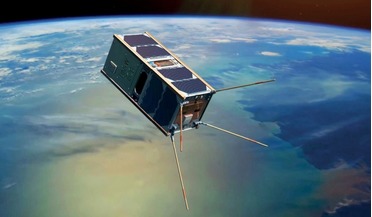
Australia’s ambitious home-grown space industry
September 2017
Australia’s ambitious home-grown space industry
...small, self-contained modules that communicate directly with a constellation of low Earth orbit (LEO) satellites. Collected data is transferred to ground stations where all the transmissions received from thousands of devices in the field are decoded...
 March 2018
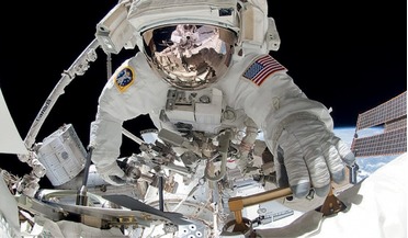
Zero gravity and the human heart
March 2018
Zero gravity and the human heart
... Upon returning to Earth there is a reverse process whereby the CVS re-adapts to Earth’s gravitational forces The data obtained in a comprehensive examination of the cardiovascular system in zero-g are different from those obtained on Earth. Assessed...
 August 2018
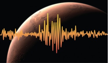
Measuring the pulse of Mars
August 2018
Measuring the pulse of Mars
... problem. The position of meteorite impacts on the other hand can be verified by overhead orbital imagery systems, so the data obtained from these quake sources can ultimately help scientists refine properties associated with Marsquakes. No matter...
 April 2019
Scanning the skies for exoplanets
April 2019
Scanning the skies for exoplanets
... every 30 minutes as it searches for that brief moment when a tiny portion of a star’s light is temporarily blocked out. Data will be collected on stars in the southern hemisphere for the first year of mission operations, followed by a sweep of the...
 September 2019
Space cybersecurity - why we mustn’t forget the basics
September 2019
Space cybersecurity - why we mustn’t forget the basics
... plausible. Naturally, one would assume that in order to lower the carbon footprint values, the source of those data would need to be controlled. Gaining control of satellites is not unheard of. Many historical attacks which involved compromising the...